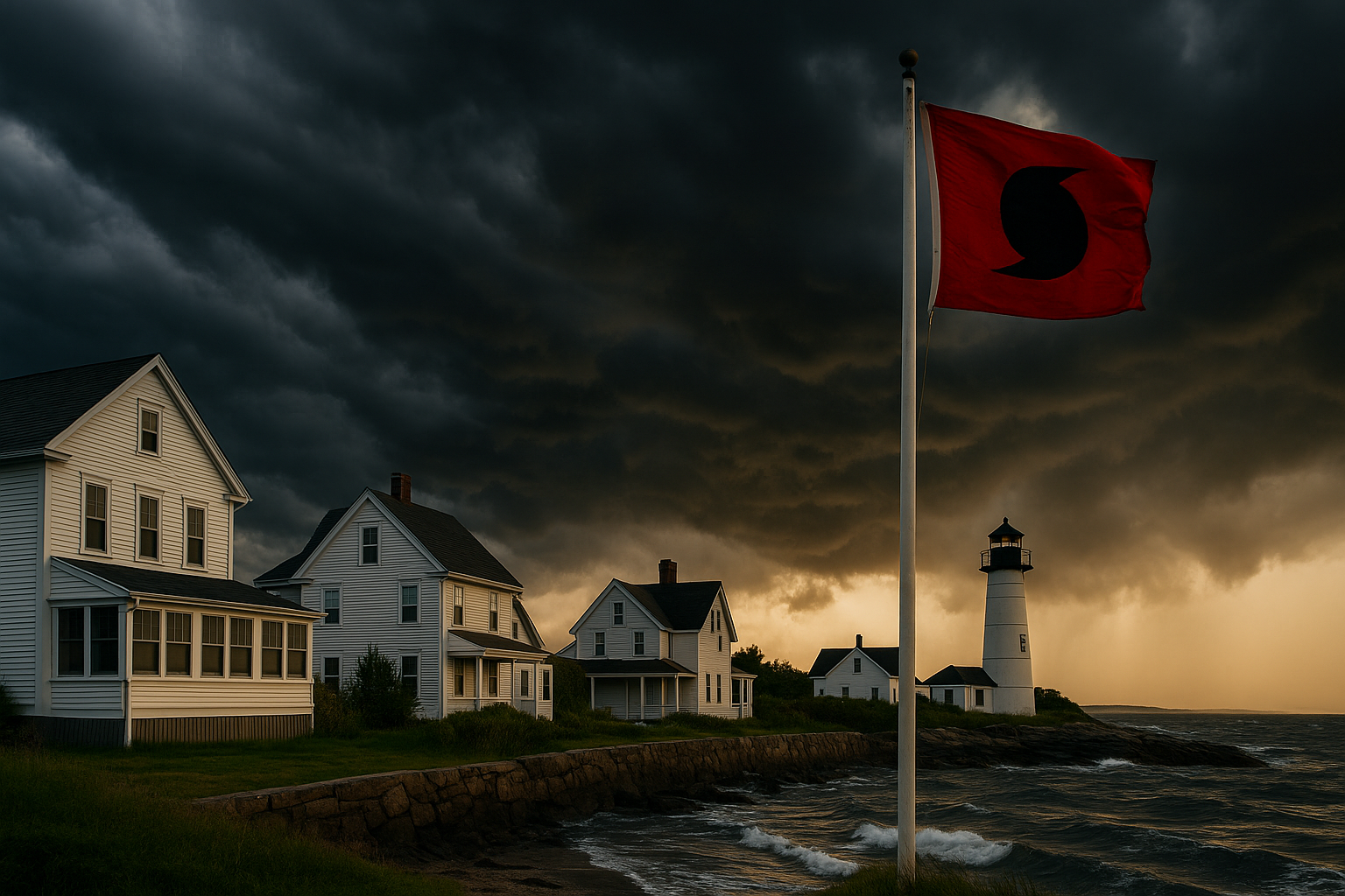
BOSTON — A red hurricane flag snapped in the late-May wind off Plum Island yesterday, the same hour the National Oceanic and Atmospheric Administration released an “above-normal” forecast for the 2025 Atlantic season: 13 to 19 named storms, six to ten hurricanes, and as many as five majors. NOAA
On paper, those figures echo 2024’s hyper-active tally. What changes the tone this year is where the warm water is parked: persistent eddies of 80-degree Gulf Stream drift closer to Long Island by mid-summer, shrinking the buffer New Englanders traditionally bank on.
Warmer Seas, Shorter Warnings
Ken Graham, director of the National Weather Service, called sea-surface heat the “fuel we can’t ignore.” BostonGlobe.com Combine that with a neutral Pacific—neither El Niño nor La Niña to dampen development—and the odds tilt toward more storms surviving the trip north.
Meteorologists at the Boston Globe note an additional wrinkle: a wobble in the Bermuda High could steer Cape-bound systems straight up I-95 if timing aligns. BostonGlobe.com
A Region Built for Nor’easters, Not Cat 3 Winds
Drive any coastal road from Narragansett to Rockport and you’ll see why insurers fret. Clapboard colonials, slate roofs pushing a century, and charming—but aging—seawalls meet code standards written long before the phrase “storm surge” entered daily vocabulary. The Massachusetts Emergency Management Agency’s perennial advice feels newly urgent: Know Your Zone before the cones of uncertainty point our way. Mass.gov
Inside the insurance files at Fire Claims Solutions, tropical leftovers such as 2021’s Henri and 2023’s Lee left a paper trail of denied “wind-driven rain” claims—mostly because homeowners couldn’t prove exactly when water breached the envelope. “Date-specific evidence is everything,” one senior adjuster told me this week, ticking off photos, weather-station screenshots, even doorbell-camera time stamps as ammunition when carriers push back.
The Flood Coverage Gap
Wind may grab headlines, but water quietly empties savings accounts. Only about one in five U.S. homeowners who consider themselves at flood risk actually carry a flood policy, according to a 2023 national survey by the Insurance Information Institute. III NFIP data show Massachusetts and Rhode Island track close to that figure. With hurricanes, it’s often not the surge but the freshwater flash flooding—think Irene in 2011—that catches inland towns unprepared.
What the Months Ahead Could Look Like
If patterns hold, the first named storm may spin up before July 4. By August, warm Gulf Stream fingers creep within 100 miles of Nantucket, offering a fast-track for any Cape Verde system that never curves east.
For property owners, preparation still outruns prediction. Walk your roofline while skies are blue; shoot a five-minute video inventory of each room; and keep digital copies of your declarations page where you can reach them if power and cell towers fail. Adjusters—independent, public, or carrier-side—will ask for those basics first.
Should a storm thread the needle, the region will lean on a small ecosystem of professional advocates to untangle policy language written for subtropical coastlines. Fire Claims Solutions, headquartered in Worcester, handled nearly 400 wind-water files after Lee; most were settled quietly but hinged on details gathered long before landfall.
A Season to Watch, Not Fear
New England has a reputation for dodging direct hits—that is, until the rare year it doesn’t. NOAA’s outlook isn’t a guarantee; it’s a probability curve. Yet probability has a way of becoming local news when a warm eddy and a high-pressure ridge refuse to budge.
So take the forecast as a nudge: trim the limbs over the roof, find out if your town’s evacuation route jams at the rotary, and scroll through your phone to confirm the last time you photographed the basement. If nothing comes of the 2025 season, you’ll have lost an afternoon and gained some peace of mind. And if a late-summer swirl decides to keep its strength past Block Island, you’ll be glad the documentation is already in the cloud—waiting, should you need it.